I'm an avid and inquisitive learner who studies
urban systems in a variety of forms. From transportation networks
in New York City to social insecurity in Uganda, I seek to
better understand how people shape their space and create
sustainable, safer and more livable cities.

-
ESRI Suite
Data Management
Interpolation
Map Creation
Spatial Analysis
Network Analysis
-
Excel Data Management
PowerPoint Poster Creation
Word Formatting
-
Land Use Analysis
Coastal Management and Flood Protection
Network and Systems Analysis
Sustainable Development
-
Scheduling
Supervising
Effective Conduit of Communication between
Upper Management and Staff
Conflict Resolution
-
Community Outreach
Public Speaking
Group Work
Team Leading
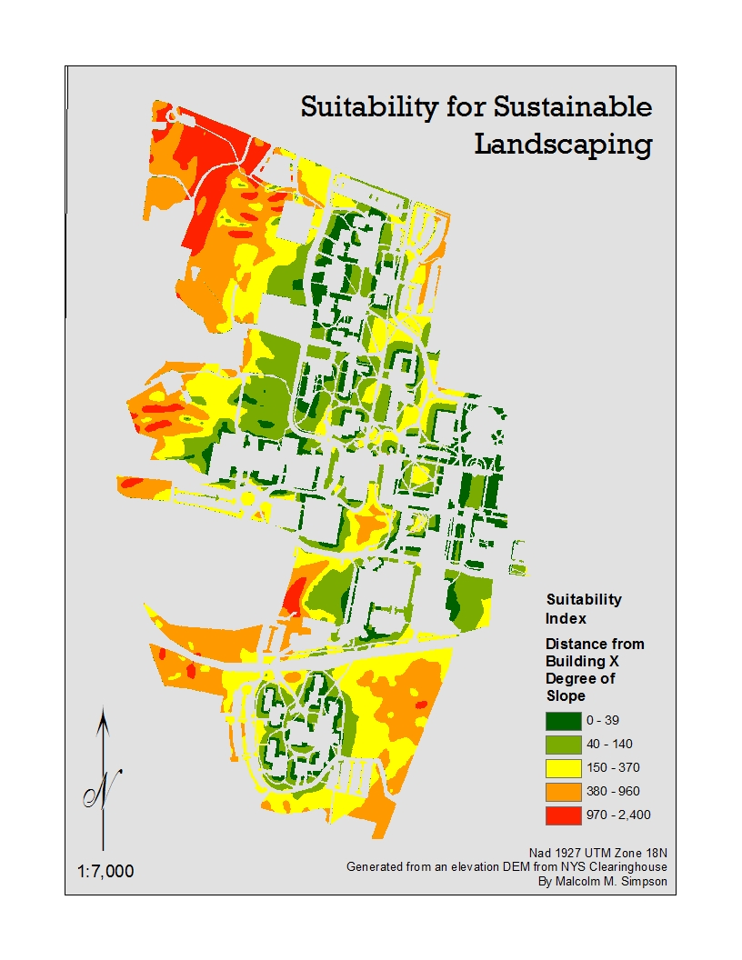
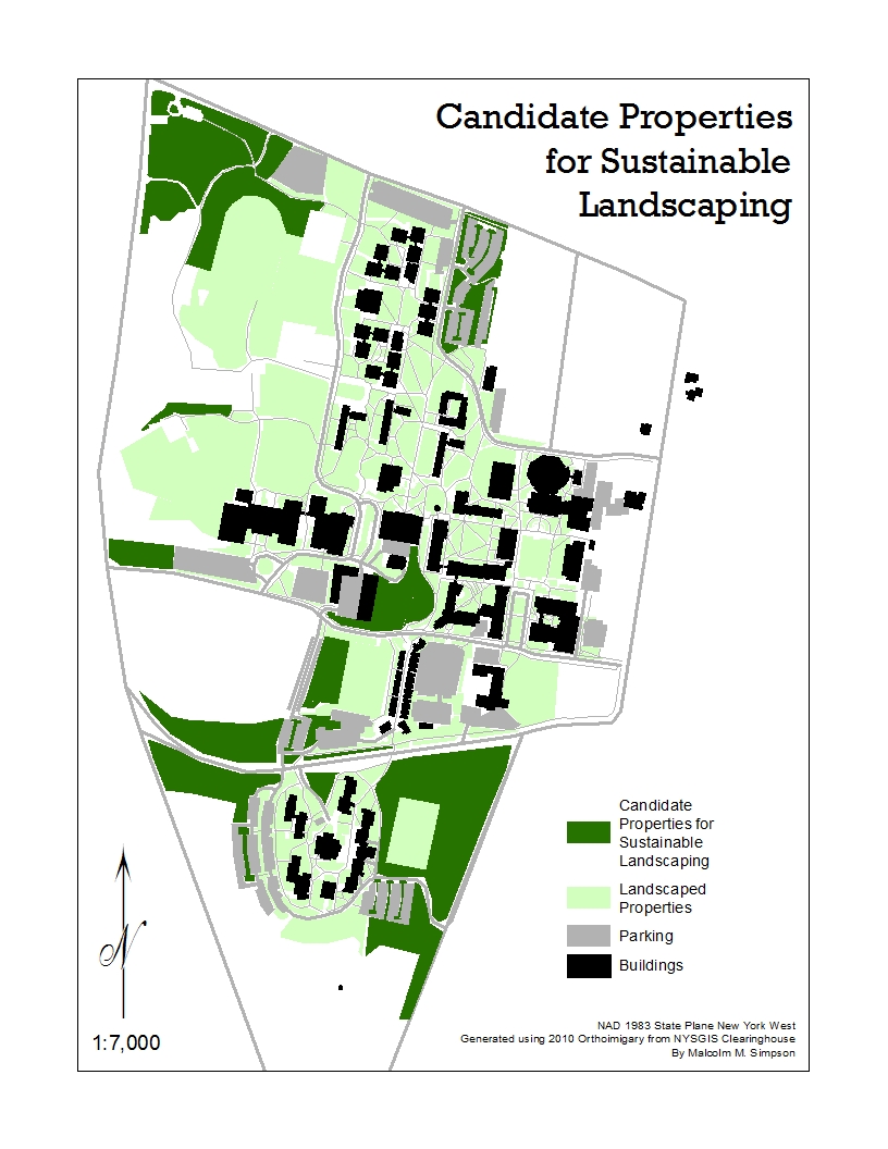
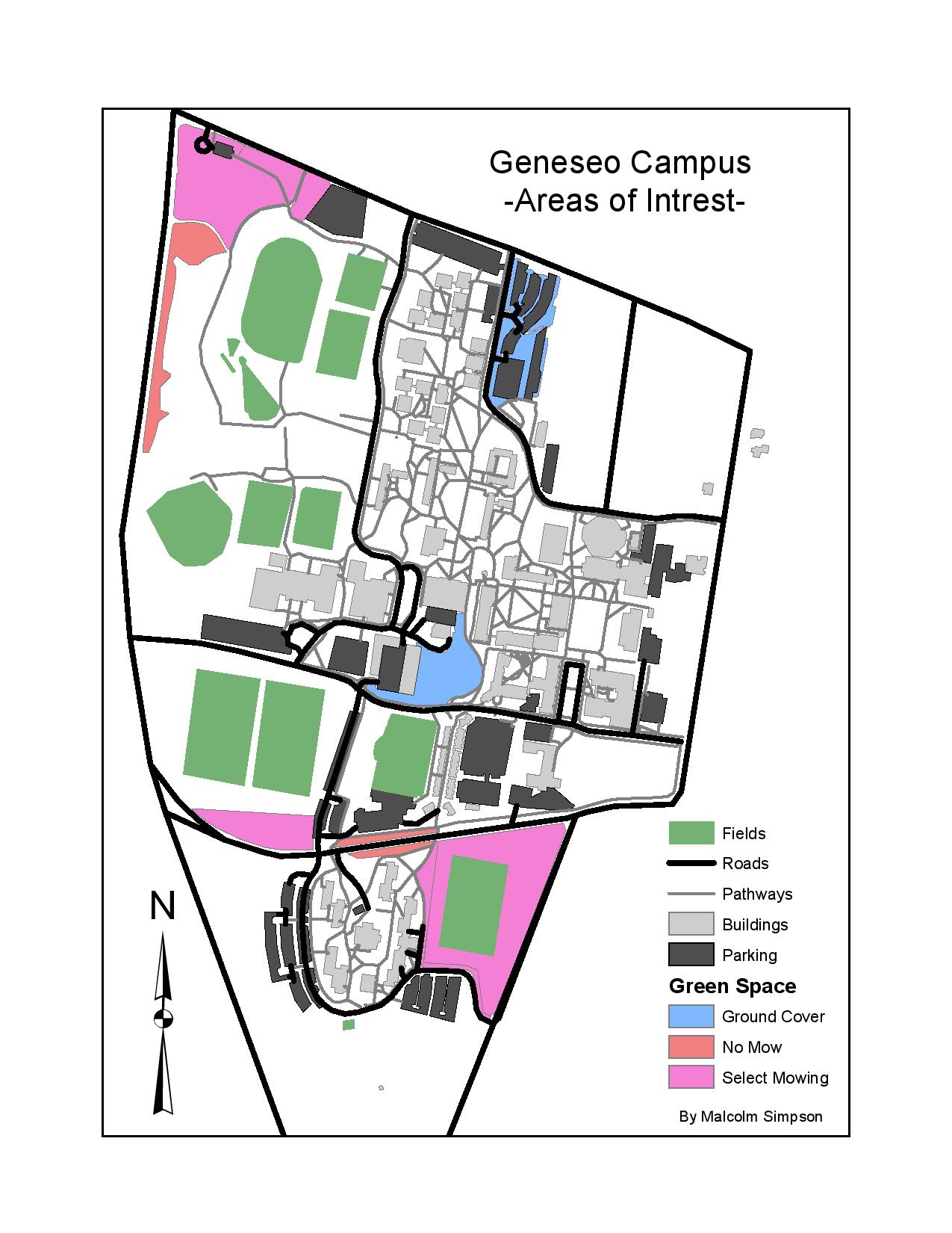
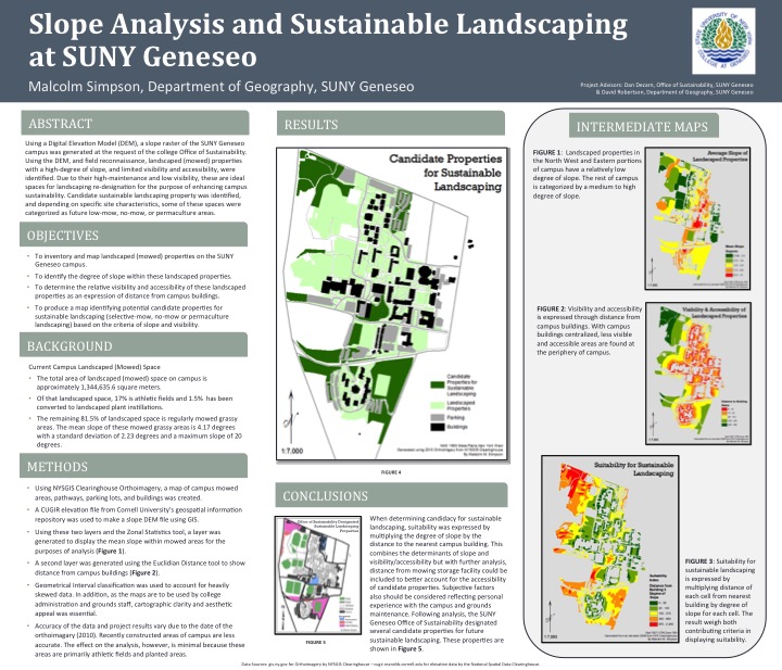
The first map series (Left) represent a site selection process conducted for the Office of Sustainability and Department of Grounds at SUNY Geneseo. Site suitability was determined by land parcel visibility from popular paths and the slope of the terrain. The steeper the terrain the more inconvenient it is for grounds to mow and maintain, while the visibility of that parcel determines how manicured the University would want to keep that parcel of land. These criteria allowed me to identify potential sites. I then deliberated with interested parties to designate the previously identified sites as permaculture ground cover, no mow areas, or select mowing areas. I took these categorizations and created a final map to be proposed to the University President for approval.
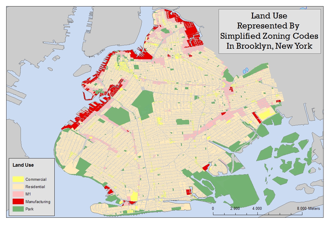
The second map series (right) investigates the impact of the L Subway line closure by analyzing land use in the borough of Brooklyn as it compares to the land use of the L Subway line service area. I generated the L Line service area using network analysis to create a 500 meter buffer along surface streets from subway entrances. Zoning data by land parcel described land use of the Brooklyn, the combined service area of Brooklyn subways, and the L line in particular. The results demonstrate a significantly higher representation of M1 zoning classification in the L Line service area when compared to the other categories. M1 is a light manufacturing classification which can be quite flexible compared to other zoning classifications. M1 light manufacturing can be repurposed to be residential and even commercial with the right renovations.
I created the above reports while studying environmental and infrastructure planning at the University of Groningen. They include comparative analysis, policy propositions, and social impact assessments. The reports demonstrate my individual and group work and my ability to work independently, as well as manage and edit group work.
